Initially:
HAWLEY - was first named BETHEL
ELKTON - was first named GARFIELD and MADISON
TANSEM - was first named LUND
PARKE - was first named OAK GROVE, PARK, PARKTOWN
1899 Plat Maps by Township
1909 Township Plat Maps - Shows Landowners
1909 Plat Maps Elmer L. Anderson Library
Township Map - 1916
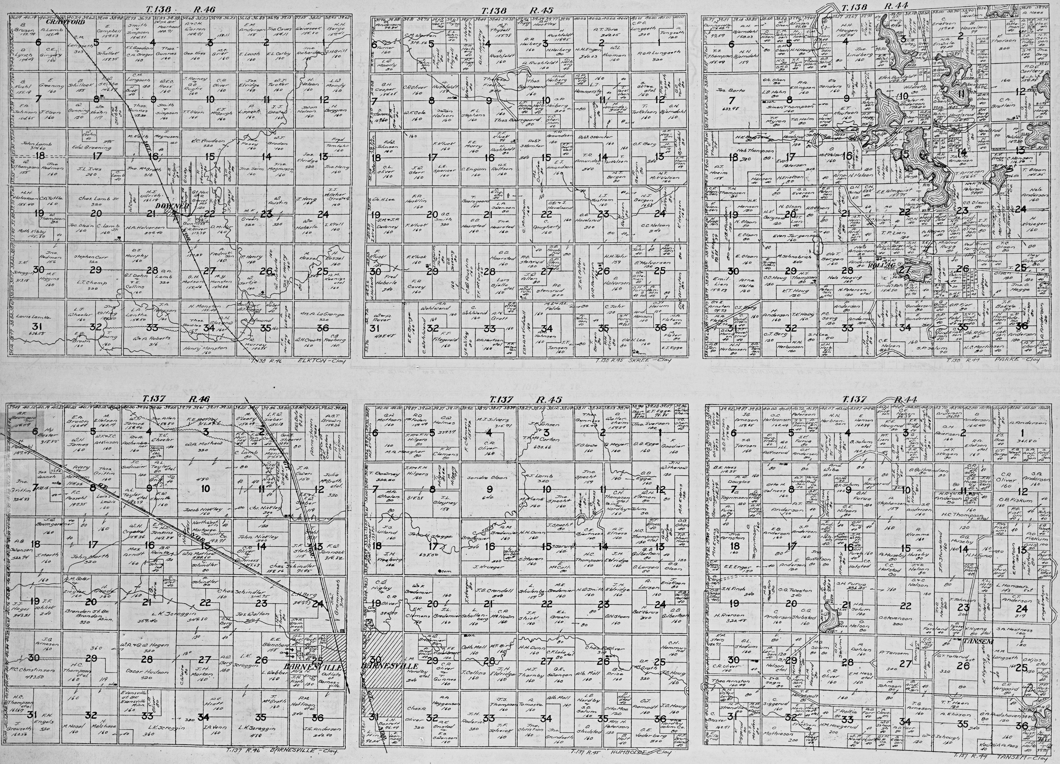
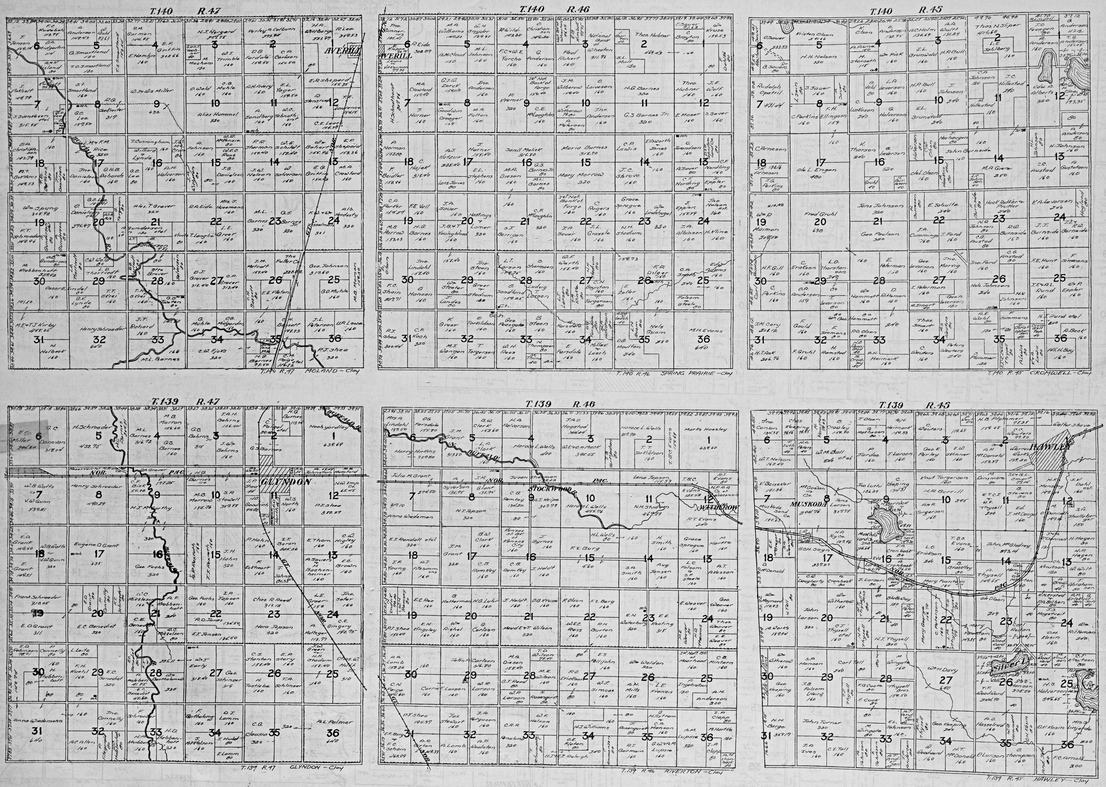
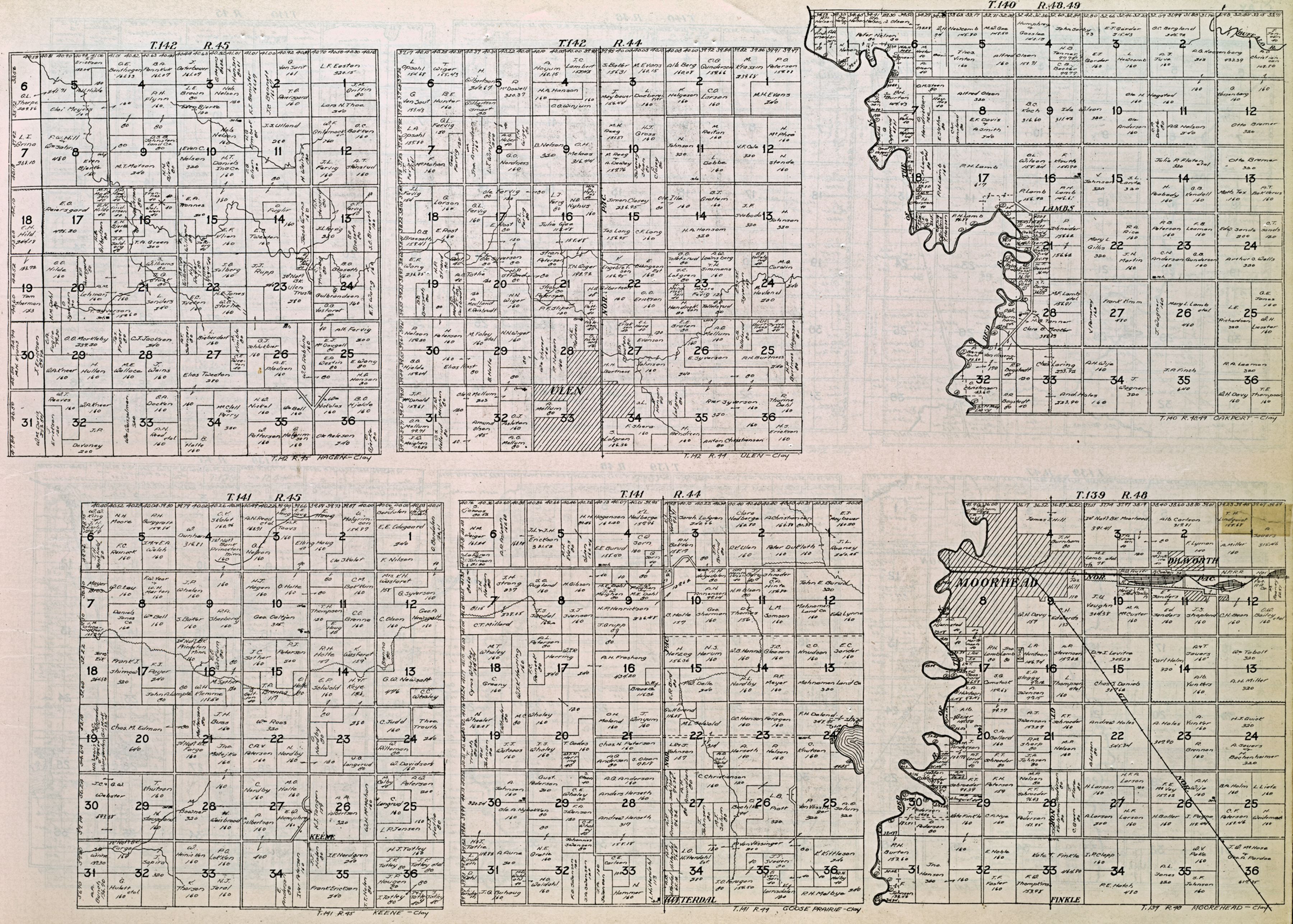
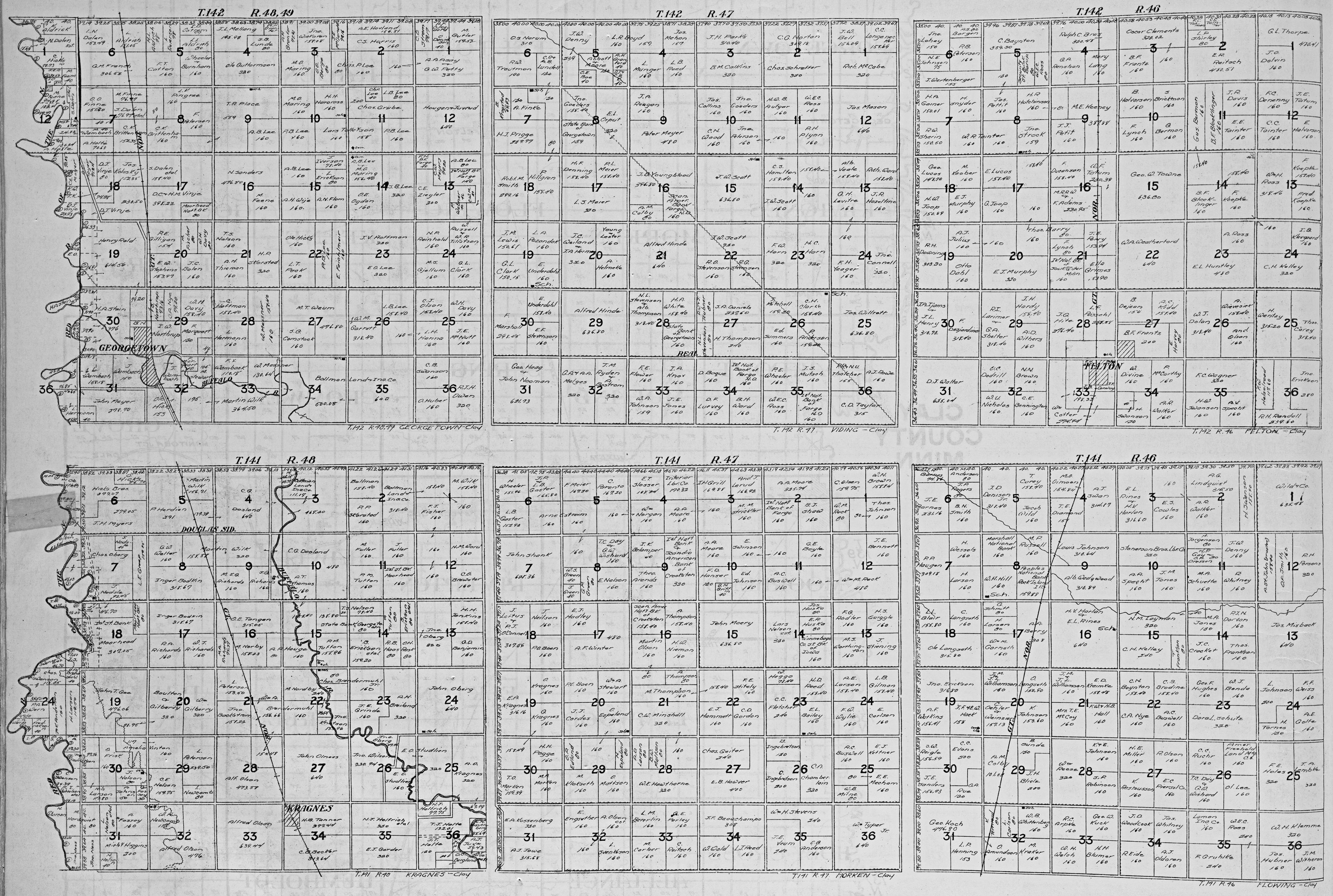
1916 Plat Maps - Shows Landowners:
T=Township, R=Range
Picture 1 - T137/R45 Humboldt, T137/R46 Barnesville, T137/R49 Tansem, T138/R45 Skree, T138/R46 Elkton, T139/R49 Parke
Picture 2 - T137/R47 Alliance, T137/R48 Holy Cross, T138/R47 Elmwood, T138/R48 Kurtz, T139/R44 Eglon, T140/R44 Highland Grove
Picture 3 - T139/R45 Hawley, T139/R46 Riverton, T139/R47 Glyndon, T140/R45 Cromwell, T140/R46 Spring Prairie, T140/R47 Moland
Picture 4 - T139/R48 Moorhead, T140/R48 Oakport, T141/R44 Goose Prairie, T141/R45 Keene, T142/R44 Ulen, T142/R45 Hagen
Picture 5 - T141/R46 Flowing, T141/R47 Morken, T141/R48 Kragnes, T142/R46 Felton, T142/R47 Viding, T142/R48 Georgetown
|